
Trace a Marlboro Street Directory
Address work in Marlboro begins with the physical parcel, not a name alone. The county’s official road map helps preserve the current street form while older records may use a hamlet or rural-post-office label. The next records are linked by the parcel’s block, lot, and sometimes qualifier. That sequence gives an address search a solid anchor. It does not turn an owner record into proof that the owner occupied the parcel.
- Normalize the street. Keep Road/Rd, Avenue/Ave, and any hamlet label found in an older source.
- Use the Monmouth OPRS property search with Marlboro selected. Enter a street fragment such as main when a full number and street produces no useful return.
- Capture the situs address, block, lot, qualifier, and displayed owner or mailing distinction. Check the selected parcel in the Tax Board portal and map context.
- Search the same block and lot in the County Clerk OPRS index. Read the recording date, instrument or book/page, legal description, and each party’s role.
- For an older household question, pair the parcel with a county directory, census, obituary, or tax-ratable source. Those records must be dated and reconciled.
- Use a narrowly described OPRA request for an offline permit, plot plan, survey, zoning file, or resolution. Give the address, block/lot, record type, and a bounded period.
Note: A street result is a starting point for parcel research, not a complete list of people associated with every home.
Marlboro Street Directory Fields
The OPRS assessor/property search separates address, owner, block-and-lot, and map work. Select Marlboro before treating an address result as township property. The address mode is the best street-directory entry point, while the block and lot are the durable keys for comparing the Tax Board, GIS, and deed index. The site’s capture shows these address and parcel controls.
| OPRS field | Type | Required | Street-search note |
|---|---|---|---|
| Township Name | Dropdown | Yes in address, block/lot, and name modes | Select Marlboro Township. |
| Address | Text | Yes in address mode | Enter the street or a fragment such as main. |
| Block | Text | Optional, used in block/lot mode | Parcel block. |
| Lot | Text | Optional, used in block/lot mode | Parcel lot. |
| Qualifier | Text | Optional | Condominium or qualified parcel. |
| Owner Name | Text | Yes in owner mode | Current owner or part of current owner. |
| Map | Map mode | No field | Zoom and right-click a location for property details. |
| Radius | Select/input | Conditional in map mode | Exact labels and options were not fully exposed in the static capture. |
| Search / Submit | Button | Action | Generic controls in the text capture. |
The portal displayed release Rel 2026-1 (06/08/2026) in the research capture. Its release date can change, so check the live record before relying on a field. The county’s MOD IV shared-services route handles assessment-data questions when the online result needs clarification.
Note: Owner-name results are assessment clues, not proof of present occupancy or a complete household association.
Marlboro Address Terms
A few property terms keep a Marlboro address search from mixing physical locations, mailing contacts, and historic descriptions. A street label may change form across a map, deed, and directory even when the same ground is involved.
- Parcel
- A defined piece of land identified in local assessment records, commonly by block and lot.
- Situs address
- The physical location of the parcel used for street and map research. It is different from an owner’s mailing address.
- Plat
- A surveyed map that depicts lots, boundaries, or streets. It helps compare a legal description with today’s map.
- Criss-cross directory
- An address-oriented directory section, when a volume actually includes one. A surname-only listing is not a reverse address result.
An owner’s mailing address may point to an agent, business, trust, or another community. It must not be represented as an owner’s residence. A person can also be associated with the situs without appearing as the owner.
Marlboro Street Records by Address
Each record below is address-keyed in a different way. Use the strongest key available, then record the source and year. The paths complement one another, but none supplies a universal household list.
| Address record | Street key | What it can show | Access route |
|---|---|---|---|
| OPRS property | Situs, block/lot, map | Current parcel and assessed-owner context | Online, MOD IV contact, or parcel-specific request |
| Tax Board list | Street, owner, block/lot, year | Year-specific tax and classification context | Online year selector or Tax Board contact |
| County GIS | Parcel polygon and road | Shape, frontage, adjacent parcels, and map layers | Online map browse; live layer details vary |
| Clerk instruments | Block/lot or parties | Recorded transfer parties and legal-title trail | OPRS, Clerk counter, or archive route |
| Zoning and code files | Address and block/lot | Permits, surveys, plot plans, resolutions, or violations | Zoning office or written Marlboro OPRA request |
| Historic directories | Street, rural address, or hamlet | Published household or business clues | Library, Historical Room, MCHA, and archive research |
A block/lot is the practical join between the property and Clerk records. A street name is less stable. The map adds geography, while a dated directory or census entry can add a household clue. Keep the category and date visible in notes so ownership, mailing, and occupancy evidence are not blended together.
Marlboro Tax List Checks
The Monmouth County Tax Board list accepts street name, township, and year in address mode. It also has owner, block-and-lot, and aggregate modes. Select Marlboro and compare the same parcel against the property search. The year selector controls what is available, so do not assume that a missing year has no record.
The official Tax Board search is shown here with its street and parcel controls.
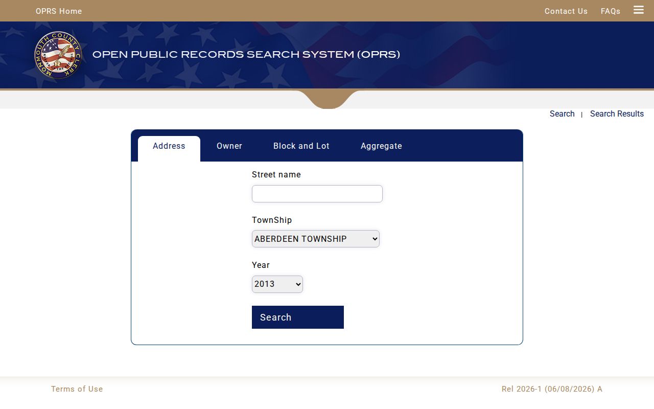
Use a tax-list row as parcel and class context, then verify the result with the property record and recorded document trail.
County property classes and deduction abbreviations need careful reading. Monmouth County’s property-code guide explains the assessment labels used in tax material.
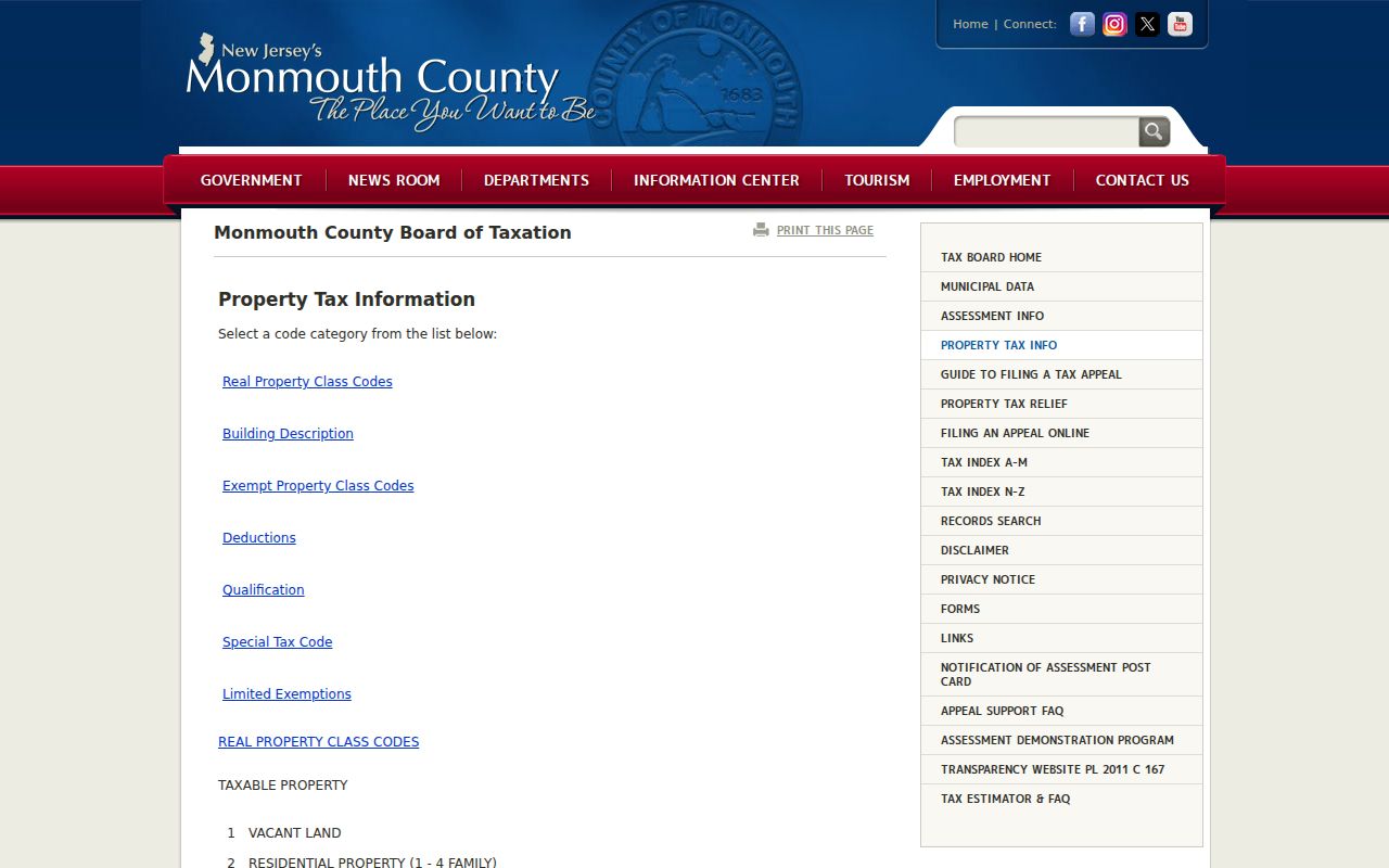
The guide can explain a class or code, but it does not identify everyone associated with a street address.
Marlboro GIS Parcel Context
The Monmouth County GIS Map Viewer is the visual leg of a street directory search. Start with the target parcel, inspect its road frontage and adjoining polygons, and then repeat property or Clerk research for the recorded block and lot. It is helpful for comparing a modern road pattern with a legal parcel description.
The research session did not verify the live Identify, Layer, or Legend controls because the ArcGIS interface is JavaScript-dependent. Treat the viewer as map-browse and parcel-context evidence. Do not assume that it supplies a current resident list or that a visible adjacent parcel proves a personal relationship. When the online map does not resolve a parcel question, the Tax Board/MOD IV route can answer assessment questions, while the County Clerk counter is the proper in-person route for recorded-deed and title research.
Marlboro Street Names and Hamlets
Marlboro’s road map uses grid labels A through M and 1 through 22 across a dispersed township. The official township history identifies Marlboro village, Morganville, Robertsville, Wickatunk, Bradevelt, and Topanemus as useful historic place names. Search a directory, obituary, or deed under those labels as well as Marlboro when a street result disappears.
No official street-number renumbering ordinance, annexation record, or renamed-street timeline was verified in the research. An old number must be checked against the dated map, deed description, and directory page rather than converted to a current address by guesswork.
Note: Postal labels and historic hamlet names are search variants, not proof that a modern parcel lies inside the township.
Marlboro Deed Chains by Street
The Clerk index is the legal-title layer of a Marlboro street directory. Use the block/lot mode or a party name, then read the date, document type, instrument or book/page, and legal description. Follow the newest deed to its prior grantor, but confirm whether the instrument covers one lot, several lots, or a larger tract. The Clerk warns that OPRS search data is informational, not a substitute for title research.
The Monmouth County Clerk OPRS search has instrument-number, document-type, block-and-lot, and name modes.
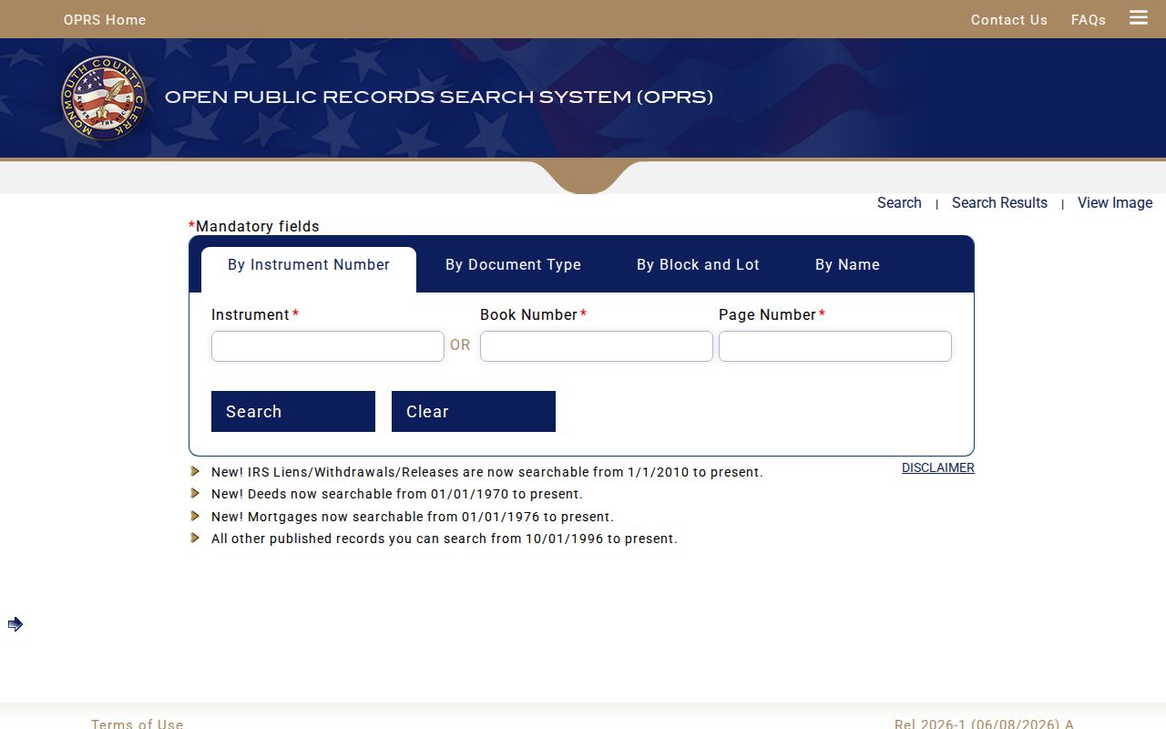
Online cutoffs are category-specific: deeds begin January 1, 1970; mortgages January 1, 1976; other published records October 1, 1996; and IRS liens, withdrawals, and releases January 1, 2010. Earlier title work belongs at the Clerk counter, State Archives, FamilySearch digitization, or local historical repositories.
Note: A legal description can cover more land than one street address, so compare it before extending the chain.
Marlboro Zoning Files by Address
Marlboro’s Zoning and Code Enforcement Division maintains block-and-lot files for zoning approvals, plot plans, surveys, permits, and resolutions. Its online information directs applicants to SDL, where a user signs up, opens Requests, and chooses Start a Zoning Application. That is an application channel, not a public historical-permit database.
Marlboro’s SDL zoning portal is shown here as the current application route.
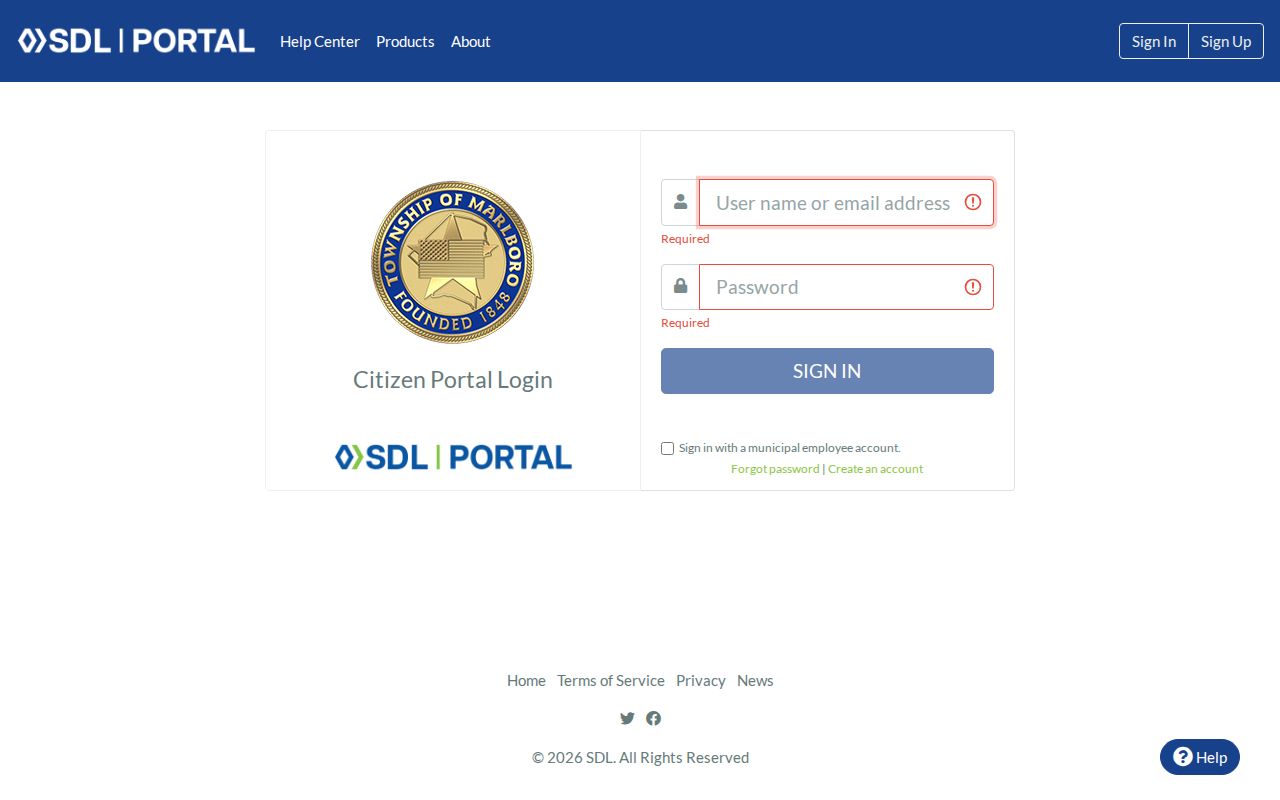
For a missing file, use the municipal Clerk’s Marlboro OPRA instructions or the written request form. Requests may be hand delivered, mailed, faxed, emailed, or submitted online. Name the address, block/lot, record type, and date span. A phone question is not an OPRA request, and the custodian need not create a new answer. The Zoning and Code Enforcement contact listed in the research is 732-536-0200 ext. 1809, with stated weekday hours of 8:30 to 4:30. Confirm availability before a visit.
Marlboro Voting District Limits
The township’s maps page and voting map can place an address within a district without identifying a household. The state’s Voter Information Portal is an individual status tool, not a street-by-street directory. Exact live form labels were not captured in the research session.
New Jersey permits a different route for voter lists through the Monmouth County Commissioner of Registration under N.J.S.A. 19:31-18. It has statutory reproduction-cost, signature-exclusion, and protected-address limits. A district map or list never establishes that every person at an address resides there.
Marlboro Street Directory History
Historic street clues are uneven. County directory runs include 1875, 1885–86, 1891, 1897–1901, 1905–17, and 1920–21, but no official source established a complete Marlboro-only run or a full reverse-directory inventory. Search the actual reel or page for an address or street section before calling it a criss-cross result. The Marlboro city directories page identifies the collection routes and their gaps.
The Marlboro library, Monmouth County Historical Room, and Monmouth County Historical Association supply the offline alternatives. A directory entry is dated household evidence, not title evidence. Pair it with a deed, tax ratable, census, church, cemetery, or obituary record when a past street association matters.
Marlboro Property Recording Alerts
Monmouth County’s 2025 notice says its free property-fraud alert service can send recording alerts by email, phone, and text. Register through the county’s Property Fraud Alert information and verify any alert with the Clerk or OPRS. The service began in 2017 and is an alert, not a filing block, title guarantee, or substitute for a deed review.
Note: An alert reports a recording event and still requires direct review of the Clerk’s corresponding record.
Marlboro Street Directory Limits
A Marlboro street directory cannot establish every person connected to an address. Parcel ownership is not occupancy. A voter status tool is not a household roster. Permit and code files can be withheld or redacted, and historic records can use a different place name or describe a larger tract. The DPPA, OPRA exemptions, Daniel’s Law, the Address Confidentiality Program, and record-specific confidentiality rules can legitimately remove information.
Lawful personal use. Use Marlboro address records for family history, property questions, civic research, or personal safety. Do not use records to stalk, harass, intimidate, or harm anyone, and do not try to defeat a lawful redaction.