
Marlboro ZIP Code Directory Coverage
Marlboro has several postal labels that matter for mail and search terms, but none alone determines a parcel's municipal identity. The county overview and USPS association list identify 07746 for Marlboro, 07751 for Morganville in Marlboro civic context, and a USPS association involving 07753 and Marlboro. Nearby Matawan, Englishtown, and Freehold labels remain nearby geography, not proof that a property lies in Marlboro. The table preserves those distinctions instead of inventing delivery boundaries or facility names that the research did not verify.
| ZIP | Areas Covered | Post Office | Notes |
|---|---|---|---|
| 07746 | Marlboro mailing-place association | Marlboro, NJ postal label | Main Marlboro mailing ZIP; a ZIP boundary is not a township parcel boundary. |
| 07751 | Morganville mailing label in Marlboro civic context | Morganville, NJ postal label | Do not treat Morganville as a separate municipality without a parcel check. |
| 07753 | USPS association with Marlboro, NJ 07746 preferred mailing context | USPS list association | Delivery labels and ZIP/city associations can differ; confirm the current USPS list. |
| 07747 | Nearby Matawan postal area | Matawan, NJ postal label | Adjacent geography is not evidence of Marlboro inclusion. |
| 07726 | Nearby Englishtown postal area | Englishtown, NJ postal label | Use GIS or parcel data to establish municipality. |
| 07728 | Nearby Freehold postal area and county-office geography | Freehold, NJ postal label | A county-office address is not Marlboro residence geography. |
The Monmouth County ZIP list is the source for this postal-overview image.
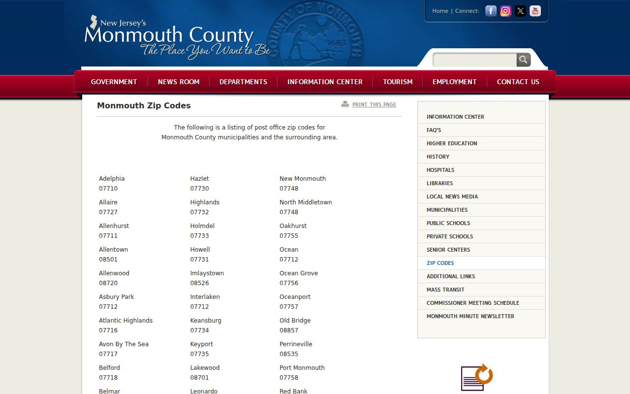
The county list is a useful first check for local mailing labels. It is not a municipal-boundary map, tax map, or evidence of who is associated with a parcel.
Marlboro ZIP Labels
The local Morganville example makes the label problem concrete. The Marlboro voting map gives Robertsville Elementary, at 36 Menzel Lane, Morganville 07751, as a polling-place address. That civic context does not convert a postal place name into a municipal conclusion. Likewise, a Freehold mailing label can identify county-office geography without identifying a Marlboro address. Keep the mailing city as it appears in the source, then confirm the property with its municipality and parcel data.
USPS mailing city terms are delivery conventions. They cannot establish a tax municipality, voting district, parcel owner, or the legal limits of Marlboro Township. When two sources display different-looking address forms, retain both forms in the research notes and use the street, block and lot, or map location to reconcile them.
Within the ZIP code directory, the county overview is a mailing reference, not a street-by-street parcel atlas. It does not establish a delivery boundary around a specific property. Preserve the source date, postal label, township result, and map check together whenever an address form affects the next search.
Marlboro Postal Map Checks
The official Marlboro road map uses grid labels A-M and 1-22 and shows the township's dispersed road pattern. It can orient a street near Marlboro village, Morganville, Robertsville, Wickatunk, Bradevelt, or Topanemus before the parcel search begins. Use the Marlboro maps page and its voting map for a second geographic check. A polling district gives civic geography, not a household list or a property boundary.
Marlboro separated from Freehold on February 17, 1848 and formed around those named hamlets. That history explains why old letters, directories, deeds, and newspapers may use a hamlet or rural-post-office label instead of a modern postal label. It also means a present ZIP code cannot be used to rewrite the place name found in a nineteenth-century record.
Note: The road map supports street orientation, but it is not a verified record of historical renumbering or a municipal-boundary decision.
Marlboro ZIP Search Workflow
Use a ZIP as a discovery clue, then move to the systems that identify a property. The documented county portals do not offer a public ZIP field, so the correct sequence turns the postal label into a township, street, map, and parcel check. This avoids rejecting an otherwise valid result simply because its mailing-place label is Morganville or another nearby locality.
- Check the county ZIP list and USPS list for the mailing labels that use Marlboro or Morganville context.
- Search the OPRS property system with Township Name set to Marlboro and the street or address wording from the record.
- Record the returned block, lot, and qualifier when present, then confirm parcel geometry and municipality in the county GIS viewer.
- Use the Marlboro voting map for district geography and the Tax Board portal for the relevant tax year.
- For older material, search the contemporary town, hamlet, and postal-place wording in directory indexes, then return to the street and legal parcel.
Once the postal label has been resolved to a street and parcel, the Marlboro street directory provides the address-focused route. The ZIP remains a filter clue, not the identity key.
Marlboro ZIP Code Search Modes
No captured Monmouth property, Tax Board, Clerk, or voter search offers a dedicated public ZIP field. Their documented controls are still useful after the postal label has narrowed the area. The table uses only modes captured from the official services and shows why a ZIP-wide name search should not be promised.
| Service | Captured search modes | ZIP field | Use after postal check |
|---|---|---|---|
| OPRS assessor/property | Township Name; Address; Block; Lot; Qualifier; Owner Name; Map | No dedicated field captured | Select Marlboro Township and search a street, address, owner, block/lot, or map point. |
| Tax Board portal | Street/Township/Year; Owner/Township/Year; Block/Lot/Qualifier/Township/Year; aggregate mode | No captured field | Use township, street, and tax year or parcel identifiers. |
| Clerk OPRS | Instrument number; document type/date; block/lot/date; name/date | No captured field | Use party, document, or parcel identifiers after location is confirmed. |
| NJ voter status search | Individual status query; legal county-list route is by election district or municipality | Not a public ZIP directory | Use only the documented individual or lawful county-list route. |
USPS provides the delivery layer. The county property and tax services provide the property layer. The GIS and voting maps provide geographic cross-checks. Each system answers a different question.
Marlboro Parcel Identity Keys
A block and lot identify the parcel used in county property and recorded-document research. The situs address is the physical parcel location. A mailing address is correspondence information and can differ from the situs because an owner uses another address, an entity, or an agent. That distinction is especially important where a ZIP or postal city looks like another municipality.
Use a simple chain: postal label to township and street, street to parcel map, parcel map to block and lot, then block and lot to tax or Clerk records. The Monmouth OPRS assessor search and Monmouth County GIS Map Viewer are the official county tools for that transition. A map result should be checked in the live interface because exact identify controls and layer names were not captured in the research session.
Marlboro ZIP Code Boundary Mismatch
ZIP and municipal geography overlap imperfectly in Marlboro. A postal place name does not prove that a parcel is inside the township, and a Marlboro civic address can carry the Morganville label. Confirm municipal identity through OPRS, the county GIS viewer, block and lot, and the applicable map. Do not infer municipal inclusion from 07747, 07726, or 07728 merely because those labels appear nearby in county geography.
- ZIP
- A postal delivery code and mailing-location convention, not a legal municipal boundary.
- ZIP+4
- An added four-digit delivery segment that narrows mail routing beyond the five-digit ZIP; it does not identify a parcel.
- PO-box ZIP
- A delivery code used for post-office-box mail. No Marlboro-specific PO-box ZIP was verified in the research.
- Carrier route
- A postal delivery grouping. It can help describe mail routing but does not establish township or parcel identity.
A mailing label can remain useful after the mismatch is noted. It helps preserve the address as a source printed it, while the parcel and map checks establish the municipal location needed for county records.
Marlboro Postal History Limits
No verified official ZIP realignment, street-renumbering, annexation, or street-renaming timeline was found for Marlboro. Do not invent one to explain an address mismatch. Compare historic maps, deeds, and the actual directory page instead. For nineteenth-century research, search Marlboro, Marlborough, and the named hamlets, then test the result against the street and legal parcel. ZIP codes cannot be projected backward before their adoption.
The USPS FAST L007 mailing-city association list is the source for this postal-reference image.
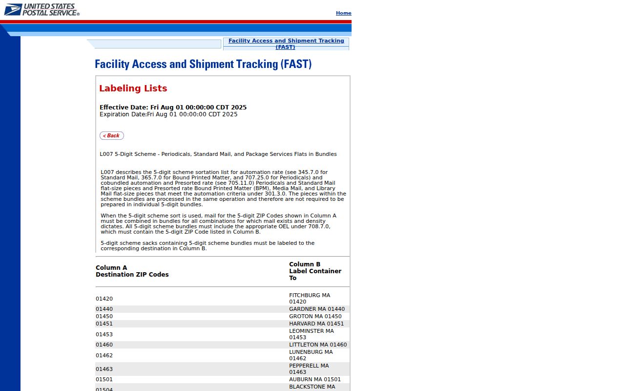
The USPS list supports a current delivery-label check. It should be used with county and municipal map sources when a record search needs a legal location rather than a mailing association.
Marlboro ZIP Access Chain
Start online with the county ZIP list and the USPS association list. Move from a postal label to OPRS property search, the Tax Board portal, and the county GIS viewer for parcel confirmation. Use the road and voting maps for local orientation and district context. For a document tied to a parcel, Clerk OPRS offers instrument, document-type, block-and-lot, and name modes, but no ZIP mode. The Clerk's online index is informational and is not a title search.
For a dated recorded-document question, the Clerk's published online cutoffs are deeds from January 1, 1970, mortgages from January 1, 1976, other published records from October 1, 1996, and IRS liens from January 1, 2010. The online date range is limited to 90 days. Older or broader work may require the Clerk counter, microfilm or archive research, or a specific request. Those dates describe record access, not a postal-boundary history.
When an online result is incomplete, use the County Clerk counter for title research, the Tax Board or MOD IV contact for assessment questions, and a written request to the appropriate custodian for a specific non-exempt record. Historic postal or hamlet questions belong with directory, map, and newspaper research at the Marlboro Branch, Historical Room, MCHA, or the State Archives. Keep the delivery label, municipal result, parcel identifier, map source, and record date together in the research notes.
Note: A postal match becomes useful evidence only after the municipality, street, and parcel identifiers agree with the record being checked.